Search this site
Googlemaps or Waze ?

Costa Rica is truly a paradise with its gorgeous beaches, lush green landscape and rich biodiversity. Navigating through such a beautiful and remote country can be tricky, especially if you enjoy adventures and prefer exploring on your own. That's where GoogleMaps or Waze come in handy.
Both Googlemaps and Waze are free to use and offer reliable directions and real-time traffic updates. In fact, Waze is owned by Google. While they have the same parent company, there are some significant differences that are important to know before you hit the road. Below we will not only discuss both apps but also the pros and cons of each.
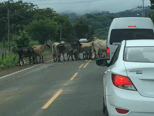
Important ! - One thing to remember while planning your trip is that Costa Rica has lots of dirt roads, some in relatively good condition and others in horrible condition, some with streams or rivers that need to be crossed, with a 4x4 truck and even then there are no guarantees. Both Googlemaps and Waze will often take you on dirt roads so additional research is needed before selecting your route and heading out on your journey.
Googlemaps
Googlemaps is a widely used navigation app that provides on-point directions, whether you need to walk, drive, or take public transportation. It’s also very comprehensive as it covers a broad range of places, including the remote areas in Costa Rica.
An important feature of GoogleMaps is the map downloading capability. Googlemaps lets you download maps for use when internet coverage may be limited or non-existent. In Costa Rica, some beautiful spots that you want to explore may not have a strong cell service or perhaps no cell service at all. It is very common, once you get away from the major cities such as San Jose and Liberia and into the hills and mountains, that there will not be any cell service at all.
One benefit of using a downloaded map with Googlemaps, is that you can turn off your cell signal, turn on GPS, and not incur data charges from your phone carrier, and still be able to effectively navigate just as if you were connected to the phone network.
This map downloading feature allows GoogleMaps to run just using GPS. This mean that the app will work even without an internet connection. This is a very important feature, especially in remote areas, of which Costa Rica has many, where the best adventures often happen but the signal strength can be a bit dicey.
That’s not all! GoogleMaps also allows you to explore restaurants, hotels, and other local businesses with reviews and ratings. Want to try the famous Costa Rican 'Gallo Pinto' ? GoogleMaps can help find the best places.
However, GoogleMaps is not without its shortcomings. Providing the fastest route isn’t always its strongest suit. Sometimes it suggests the shortest route, but not necessarily the quickest one. Also, the traffic updates are not as real-time as you may want them.
Now, let's switch lanes
to Waze.
Waze
Unlike GoogleMaps, Waze is more of a community-driven app, meaning the data is primarily sourced from its users. So, the real-time traffic updates you get are shared by Wazers on the road.
With Waze, you are more likely to get the quickest rather than the shortest routes as it is designed to save your time. Waze users keep each other updated about traffic, but also road accidents, closures, obstacles, and even police traps.
Just like GoogleMaps, Waze also offers a list of nearby businesses. So if you are craving a 'Casado' after a tiring adventure, and want to explore local eateries, Waze can show you options too!
But, the downside of Waze is that it needs a phone connected to a cell service to
operate, and unlike GoogleMaps, Waze doesn't work offline. It requires
a data connection to provide directions and updates. If you are using Waze and your phone dies, needs to be recharged or restarted, and you are not in an area with cell phone service, you are out of luck and better have an alternate navigation plan ready.
This limitation could be quite inconvenient if you’re heading to remote areas in Costa Rica, where cell service is often sketchy. It can be a turn off for people who want to explore off the beaten path, but still desire the comfort of a reliable navigation app .
Waze also tends to be a bit heavy on data usage. The cost could quickly add up if you have a limited data plan while traveling around Costa Rica.
Comparing
GoogleMaps and Waze, one thing stands out – GoogleMaps takes the crown
when it comes to usage in areas with an unstable internet connection. This makes navigating through remote Costa Rican landscapes hassle-free
and more enjoyable. It also wins in cost effectiveness and reduces or eliminates data charges if used in GPS mode with a downloaded map.
Now, you might be wondering, which navigation
app best suits your adventure needs in Costa Rica? Waze can be a wonderful companion if you’re sticking to areas with good
cell service and like the idea of having community-driven data with real-time
updates about the road conditions. It's particularly useful in busy
Costa Rican cities like San Jose, Liberia or Tamarindo. However, if you plan on exploring the more remote regions of Costa Rica, I would strongly recommend Googlemaps.
In Summary
In the end, your
decision to "Use Googlemaps or Waze" largely depends on your personal
preferences and the nature of your trip. Both have their own strengths
and can greatly assist your Costa Rican adventure. Here is a quick comparison of which app is better at certain things:
- Minimizes data usage and cost - Googlemaps
- Real time road updates, e.g. accidents, obstacles, road closures, police - Waze
- Quickest route - Waze
- Works without a cell phone network - Googlemaps
- Allows maps to be downloaded - Googlemaps
How to Create and Download a Map to Googlemaps
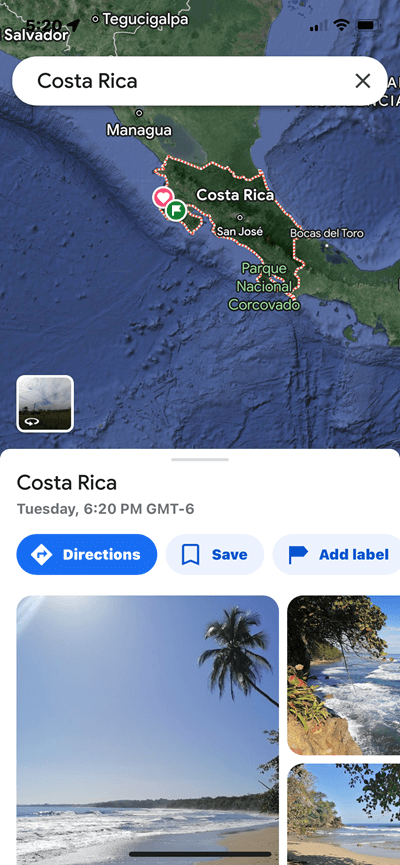
Step 1 - Open the Googlemaps app and enter Costa Rica as your destination. Then tap on "Costa Rica" just above the blue "Directions" button.
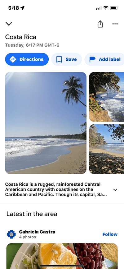
Step 2 - Tap the three dots in the upper right corner.
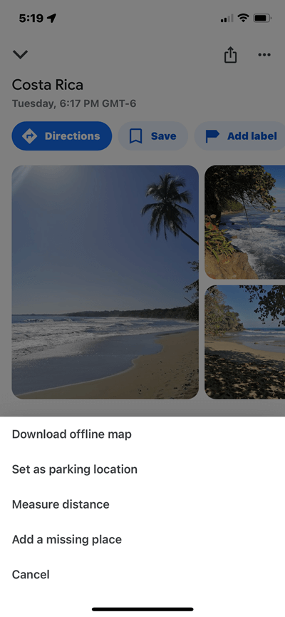
Step 3 - Tap"download offline map".
Step 4 - Move the highlighted rectangle over the area of Costa Rica that you will be navigation. You may not be able to select the entire country. Then tap "download".
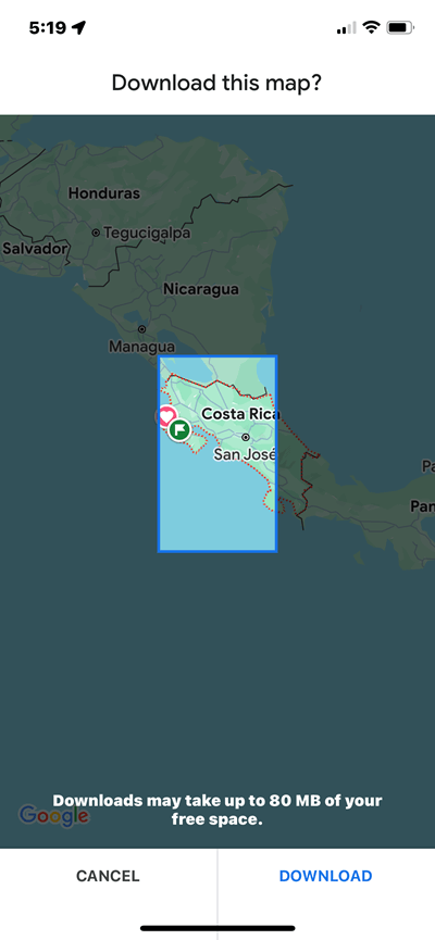
The map will then download to your phone and will automatically update periodically to provide the latest data.
How to Delete a Downloaded Map from Googlemaps
- Open the Googlemaps app on your phone.
- Tap your profile picture or initial in the upper right corner.
- Tap "Offline Maps"
- Tap the map that you want to delete.
- Tap delete.
